



constellr High-precision Versatile Ecosphere (HiVE) Thermal Mission:Technical Overview and Application Insights
Daniel Spengler

1*, Riccardo Benvenuto
1,Beate Tempel
1,Tobias Leismann
1,Christian Mittermaier
1,Marius Bierdel
1,Tobias Menne
1,Iliass Tanouti
2,Cassi Welling
1,Max Gulde
1- constellr GmbH, info@constellr.com, Germany
- constellr SA, info@constellr.com, France
* Author to whom correspondence should be addressed.

Abstract
constellr’s thermal Earth observation mission represents a significant advancement in global thermal monitoring. Equipped with sophisticated sensors capable of high-resolution imaging, this mission enhances understanding across agriculture, urban planning, human health, and security applications. This paper explores the technical details of constellr’s sensor technology, calibration and validation methodologies, and practical use cases illustrating its impact.Keywords
LST, Thermal Remote sensing, Urban Heat, Drought Stress, New Space1. Introduction
With increasing global temperatures and intensified climate variability, the demand for high-resolution thermal data has become more critical than ever. Accurate thermal information is indispensable for managing resources, optimizing urban development, safeguarding public health, and enhancing security and defense capabilities. Despite advancements in satellite remote sensing technology, a significant gap remains in the availability of high-resolution, high-frequency thermal infrared (TIR) data. Current operational thermal satellites, while valuable, typically offer either insufficient spatial resolution or infrequent revisit times, limiting their effectiveness for precise, time-sensitive applications such as crop stress detection, urban heat island analysis, and rapid disaster response. constellr addresses this critical gap by offering advanced thermal imaging technology capable of delivering detailed thermal observations at unprecedented resolutions and frequencies. Its thermal infrared sensors enable near-continuous, detailed monitoring of Earth’s surface temperature, fulfilling an urgent need across multiple sectors and driving a new era of informed decision-making.
Integrating these insights, this paper details the sensor technology behind the constellr High-precision Versatile Ecosphere (HiVE) mission, discusses the rigorous calibration and validation methodologies ensuring data reliability, and explores key applications in agriculture, urban planning, public health, and security.
2. Technical Specifications and Sensor Technology
The constellation payload consists of two imaging instruments: a Thermal Infrared (TIR) sensor and a Visible and Near-Infrared (VNIR) sensor.
The TIR instrument, custom-built by OHB for constellr, operates in the spectral range of 8-12 µm and captures data across four distinct spectral bands (8.6 µm, 9.2 µm, 10.6 µm, and 11.75 µm). This instrument employs a Mercury Cadmium Telluride (MCT) detector array (640 × 512 pixels), cooled cryogenically to enhance sensitivity. The TIR telescope incorporates a six-lens refractive optical system, achieving precise Earth imaging from a sun-synchronous orbit at approximately 540 km altitude. Detailed technical specifications, see Table 1.
Complementing the TIR sensor, the VNIR camera employs a commercially available Simerasense Multiscape100 system. This instrument captures imagery across 10 spectral bands (400 nm – 1000 nm), matching Sentinel-2 spectral bands, facilitating cross-sensor interoperability. Ground sampling distance (GSD) varies from 10m to 60m depending on spectral bands and binning configurations, enabling detailed surface characterization.
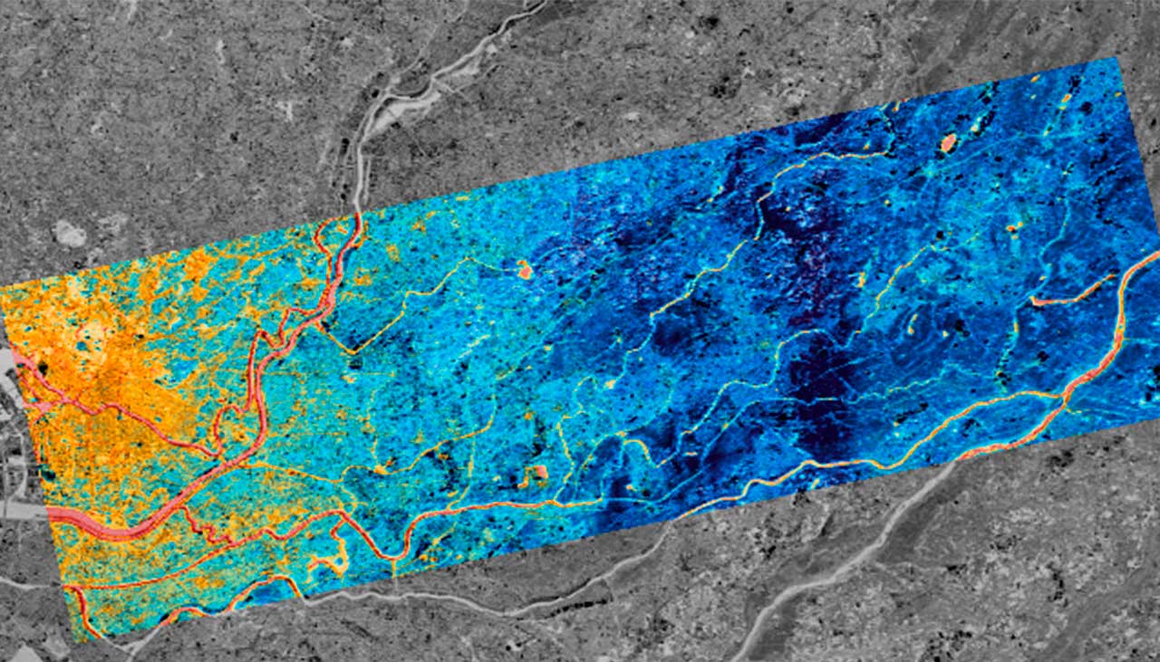
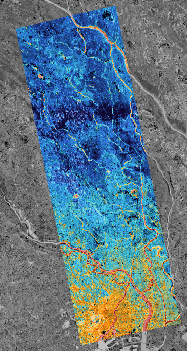
HiVE Skybee 1 satellite was developed supported by ESA within the InCubed program and successful launched in January 2025 is operated by constellr and enables the tasking-based acquisition of the earth surface with a swath of 18.5km and of nadir pointing capabilities with up to ±30°. The acquisition time of SkyBee1 is 10:30 AM LTDN (see Figure 1). The launch of Skybee2 is scheduled for June 2025. Additional Skybee satellites are planned on a yearly launch cadence.
Table 1: Technical specification of constellr HiVE Skybee satellites
| Mission parameter | VNIR | TIR |
| Spectral Bands (µm) | 0.44 | 0.49 | 0.56 | 0.67 | 0.71 0.74 | 0.78 | 0.84 | 0.87 | 0.95 | 8.6 | 9.2 | 10.6 | 11.8 |
| LST uncertainty | <2K for mid latitudes | |
| LST sensitivity | 0.03K | |
| Geolocation accuracy (m) wrt to Sentinel-2 reference image | <10m | 1.5 pixels (42m) (CE90), for <10° off nadir angle |
| Band to band registration accuracy | 0.2 pixels (1sigma) | 0.2 pixels (1sigma) |
| Ground instantaneous field-of-view (m x m) | 10 x 10 (Band 2/3/4/8) 20 x 20 (Band 5/6/7/9) 60 x60 (Band 1/10) | 30 x 30 |
| Signal-to-noise ratio (SNR) | 10m: >1:200 | 20m: >1:170 60m: >1:500 | B01: 1:530 | B02: 1:450 B03: 1:540 | B04: 1:150 |
| Swath width / length / day (km) | 20 / 1000 | 18.5 / 1000 |
| Product Level for users | L2A | L2A |
| Metadata and Data Format | Cloud Optimized GeoTiff | STAC | Cloud Optimized GeoTiff | STAC |
| Data Access | API or GUI Web Platform | API or GUI Web Platform |
The absolute temperature accuracy of the L2 LST product is highly depended on the atmospheric conditions the imagery is taken from. The expected range at a radiometric instrument error of the TIR imager of ≤2% is between 1.2K in dry arctic conditions and 2.2K in humid tropical conditions. The constellr LST algorithm generates high-resolution, image-based land surface temperature optimized for dedicated surfaces, using prior emissivity estimation, advanced atmospheric correction with real-time MODTRAN simulation, and a flexible multi-band Equivalent Temperature approach. constellr’s cloud masking algorithm utilizes a U-Net deep convolutional neural network, combining advanced artificial intelligence with a extensive training dataset based on the Cloudsen12 dataset (Aybar et al. 2022), extended with additional samples for challenging areas and environments.
The operation temperature range is between -20°C and +80°C (253K to 353K).
3. Calibration and Validation Methodology
To ensure data accuracy and reliability, constellr adopts robust calibration and validation (Cal/Val) processes. It combines all procedures to create the calibration parameters required to process the data to its highest radiometric and geometric quality in the L1 processors. The full Cal/Val environment contains summarizes tools for:
1. Radiometric Calibration (PRNU correction, absolute calibration)
2. Geometric Calibration (Scale Calibration, Optical Distortion calibration)
Cal/Val involves pre-launch laboratory calibrations, coupled with ongoing in-flight calibration maneuvers. Ground-based validation sites equipped with radiometers and spectrometers. constellrs patented satellite cross-calibrations procedure guarantees high data quality, essential for critical decision-making across various sectors. All Cal/Val activities are supported by ESA optical mission performance cluster (oMPC) in the framework of the Copernicus Contributing mission.
4. Applications and Use Cases
4.1. Stress Identification in Agriculture for Water Efficiency
The high-resolution thermal data from constellr enables precise identification of crop water stress through analysis of land surface temperature (LST) variability. Thermal imaging assists farmers in pinpointing areas requiring targeted irrigation, significantly improving water use efficiency. By monitoring soil moisture and crop transpiration rates with fine-scale thermal data, agricultural management can shift from traditional resource-intensive practices towards precision agriculture, mitigating drought impacts and enhancing food security (Khanal et al. 2017).
4.2. Urban Heat Monitoring and Smart Urban Planning
Early data from constellr’s SkyBee-1 satellite demonstrates how urban materials and structures distinctly influence thermal environments. For instance, industrial zones and solar installations display unique thermal signatures. Water bodies act as natural thermal buffers, moderating urban temperatures. Such detailed insights facilitate smarter urban design, guiding optimal placement of cooling infrastructure, green spaces, and reflective materials (Ouyang et al. 2024). According to the International Energy Agency (IEA, 2025), improved urban thermal management is essential as energy demand for cooling continues to rise, projected to more than double by 2050. constellr’s data thus supports proactive, climate-resilient urban planning, reducing energy costs and enhancing sustainability.
4.3. Human Thermal Comfort and Public Health
With urban heat islands exacerbating public health risks, especially during extreme heatwaves, constellr’s thermal imaging capabilities offer a valuable tool for health risk assessment. Ballester et al. 2023 highlight that urban temperature elevations significantly increase mortality risks and potentially leading to millions of temperature-related deaths by century’s end. High-resolution thermal data enables the identification of heat-stressed urban areas, assisting health authorities in developing targeted interventions like cooling centers, shaded zones, and urban greening initiatives. This precise monitoring capacity significantly improves community resilience to heat-related health challenges.
4.4. Civil security and Defense Applications
High-resolution thermal data from constellr also carries significant implications for civil security and defense. Thermal imaging can detect subtle anomalies indicative of infrastructure stress, clandestine activities, or environmental hazards. Early detection of thermal irregularities in critical infrastructure, such as railways or power grids, allows prompt intervention, reducing maintenance costs and enhancing operational security. The ability to identify thermal signatures associated with industrial activities or disruptions also provides strategic insights crucial for national security and crisis management.
5. Conclusions
constellr’s thermal mission marks a critical innovation in Earth observation, delivering unprecedented high-resolution thermal imagery. Its robust sensor technologies, combined with rigorous calibration and validation methods, ensure data integrity and applicability across diverse sectors. From revolutionizing agriculture and urban planning to enhancing public health and national security, constellr’s thermal intelligence sets a new benchmark in global environmental and societal resilience efforts. In synergy with the upcoming public missions TRISHNA (CNES/ISRO), LSTM (ESA) and SBG (NASA) a new era of thermal data is at the horizon. constellr HiVE data can serve pre-cursor data for these missions for the development of applications and in future used in synergy leveraging the concept of a virtual constellation.
Author Contributions
Conceptualization – All authors, Funding acquisition – Tobias Leismann, Writing – original draft – Daniel Spengler, Writing – review & editing – All
Declaration of competing interest
The authors declare that they have no known competing financial interests or personal relationships that could have appeared to influence the work reported in this paper.
Acknowledgement
We sincerely thank the entire constellr team for their outstanding dedication, expertise, and tireless efforts that have been instrumental in realizing the successful launch of the constellr satellite missions. Especially we thank our technical partners OHB System AG, Kongsberg NanoAvionics and Fraunhofer EMI for their ongoing support. We also gratefully acknowledge the ongoing engagement provided by the German Aerospace Center (DLR), and our scientific and commercial partners, whose collaboration and commitment have been crucial in developing and implementing this ambitious satellite mission.
Funding
We thank ESA Incubed program for substantial funding of the development of HiVE Skybee1 (4000137650/22/I-DT-bgh). We thank ESA and EC for funding constellr in the framework of the ESA contributing missions Cat.1 for supporting the Calibration and Validation to ensure data quality for users (4000140882/23/I-EB).
References
Aybar, C., Ysuhuaylas, L., Loja, J. et al., 2022. CloudSEN12, a global dataset for semantic understanding of cloud and cloud shadow in Sentinel-2. Sci Data, 782. https://doi.org/10.1038/s41597-022-01878-2
Ballester, J., Quijal-Zamorano, M., Méndez Turrubiates, R.F. et al., 2023. Heat-related mortality in Europe during the summer of 2022. Nature Medicin, 29, 1857–1866. https://doi.org/10.1038/s41591-023-02419-z
constellr GmbH | Belgium (SA) | France SASU, 2025. Capability Statement. https://public-data-213979744349.s3.eu-central-1.amazonaws.com/capability-statement/Capability+statement+constellr+PUBLIC+v1.3.pdf. (accessed March 27, 2025)
IEA, 2025, Global Energy Review 2025, IEA, Paris. https://www.iea.org/reports/global-energy-review-2025, Licence: CC BY 4.0 (accessed March 27, 2025).
Khanal, S.; Fulton, J.; Shearer, S., 2017. An overview of current and potential applications of thermal remote sensing in precision agriculture. Computers and Electronics in Agriculture,139. https://doi.org/10.1016/j.compag.2017.05.001
Ouyang, X.; Sun, Z.; Zhou, S.; Dou, Y., 2024. Urban land surface temperature retrieval with high-spatial resolution SDGSAT-1 thermal infrared data. Remote Sensing of Environment. 312. https://doi.org/10.1016/j.rse.2024.114320
Publisher’s Note
The statements, opinions, and data contained in all publications are solely those of the individual author(s) and contributor(s) and not of Recent Advances S.L. and/or the editor(s). Recent Advances S. L. and/or the editor(s) disclaim responsibility for any injury to people or property resulting from any ideas, methods, instructions, or products referred to in the content.